


Hoytsville Voting District, Summit County, Utah
About
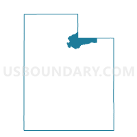
Outline

Summary
| Unique Area Identifier | 679964 |
| Name | Hoytsville Voting District |
| County | Summit County |
| State | Utah |
| Area (square miles) | 26.99 |
| Land Area (square miles) | 26.99 |
| Water Area (square miles) | 0.00 |
| % of Land Area | 99.99 |
| % of Water Area | 0.01 |
| Latitude of the Internal Point | 40.86469430 |
| Longtitude of the Internal Point | -111.39008950 |
Maps


Graphs
Select a template below for downloading or customizing gragh for Hoytsville Voting District, Summit County, Utah


Neighbors
Neighoring Voting District (by Name) Neighboring Voting District on the Map
- Canyon Creek 4A, Morgan County, UT
- Coalville North Voting District, Summit County, UT
- Coalville South Voting District, Summit County, UT
- Oakley Voting District, Summit County, UT
- Spring Hollow Voting District, Summit County, UT
- Upton Voting District, Summit County, UT
- Wanship Voting District, Summit County, UT
Top 10 Neighboring County Subdivision (by Population) Neighboring County Subdivision on the Map
Top 10 Neighboring Place (by Population) Neighboring Place on the Map
Top 10 Neighboring Unified School District (by Population) Neighboring Unified School District on the Map
- Morgan School District, UT (9,469)
- South Summit School District, UT (7,001)
- North Summit School District, UT (4,922)